Friday, June 11, 2010

Continental Glaciers


Drift: A deposit of snow created by the wind. They resemble sand dunes, and are created and formed in a very similar manner.

Ice Ages:
A period of long-time reduction of temperature of the Earth that resulted in expansion of ice sheets.
Drumlin: A whale shaped hill that has been formed by glacial ice acting on underlying till or ground moraine. Its long axis is parallel to the ice with the more blunt end facing the glacial movement.
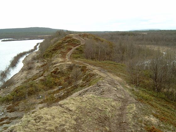
Esker: A long, winding ridge of gravel and sand which occur often in North America and Europe. Formed in ice wall tunnels by streams that flow under glaciers. They may also form above glaciers when sediment settles in crevices.

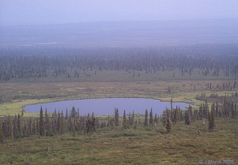
Kettle Lake: Shallow, sediment filled body of water that has been formed by retreating glaciers or draining floodwater. An example of this is Lake Wilcox in Ontario.

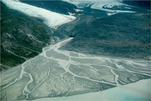
Outwash Plain: A plain formed of sediments deposited by the meltwaters at the end of a glacier. They are most common in Iceland.


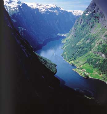
Fjords: A long narrow inlet that has steep sides created in a valley that has been carved by glacial activity.

Thursday, June 10, 2010

Alpine Glaciers

Till: Unsorted glacial sediment that is deposited directly beside the glacier. It can vary from clay, to a mixture of clay, sand, gravel, and boulders. Deposited at the terminal moraine, along the lateral and medial moraines, and in the ground moraine of a glacier.
Cirque: An amphitheatre like valley head, formed at the head of a valley glacier by erosion. It is a concave shape open on the downhill side with steep cliff like slopes on either side where ice and glaciated debris combine and converge. A notable cirque in northern america would be the cirque tower in wyoming.

Arete: A thin almost knife life ridge that is formed when two glaciers erode parallel u-shaped valleys. The arete is what separates these two valleys. An example of this in North America would be Clouds Rest in California.

Medial Moraine: Accumulation of glacial debris that runs down the centre of a valley floor. It is formed when two glaciers meet and the debris on the edges of the valley sides join and are carried on top of the enlarged glacier. Canada has a medial moraine that is 1 km in size that is in Kluane National Park.

Lateral Moraine: Parallel ridges of debris that are deposited along the sides of glaciers. Because of the fact that they are deposited on top of glaciers they rarely erode and remain as high ridges.

Terminal Moraine: Ridges of debris that are deposited at the end of a glacier. The glacier acts much like a conveyor belt and carries the debris from the top to the bottom.


Hanging Valley: A tributary valley with the floor at a higher relief than the main channel into which it flows. They are commonly associated with a tributary glacier flowing into a glacier of a larger volume.

Crevasses: A crack in an ice sheet or glacier that. They often have vertical or near vertical walls.

Glacial Movement: The motion of glaciers that is similar to that of rivers of ice. This has played an important role in forming many landscapes. This movement can be fast up to 30m/day or only 0.5m/year. All of this motion is caused by gravity.

Receding Glaciers: Many of the glaciers that we know today are receding due to the climate change and melting of them. An excellent example of this here in British Colombia would be The Columbia Ice field. The amount of snow that falls each year is not enough to make up for the amount of snow that is melting each year.

Stationary Glacier: A glacier which has an accumulated snowfall that is equal to the melting of the previous snows. Though it says they are stationary it does not refer to the fact that they are not in motion, but the fact that they are not decreasing in size.


Thursday, April 29, 2010

Frontal or Cyclonic Rainfall


ADVECTION FOG: Occurs when moist air passes over a cool surface via wind and is cooled. It is most common at sea when the tropical air collides with the cooler waters.

RADIATION FOG: Occurs as a ground fog. It is caused be the radiation cooling of the Earth's surface, and often only occurs at night time. It will never form over a water surface, and often covers a very side area. The radiation causes the lower air to be heated causing evaporation of the lower part of the fog and giving it the appearance of lifting. It is common in high pressure areas and where there are clear skies.
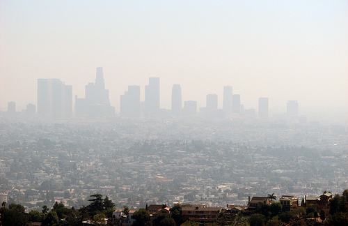
SMOG: A kind of air pollution, meaning both fog and smoke mixed together. It often comes from the emissions of both vehicles and factories. It is also caused by large amounts of coal burning and mixing with smoke and sulfur dioxide.

HURRICANE: A storm system characterized by a large low pressure center and accompanied by thunderstorms, strong winds, and heavy rain. They feed on the heat that is released when moist air rises, causing the condensation of water vapor in moist air. They originate near the equator and often only happen in tropical areas. Though they produce strong winds and rain they are also able to created high waves, and tornadoes. They develop over large bodies of warm water, but begin to lose their strength as they move over the land, meaning that areas close to the coast often receive the most damage. They are very damaging to populations however they can also be quite beneficial to drought situations. They can also help carry heat and energy away from the tropics and move it to temperate latitudes, making it an important part of circulation in the atmosphere and maintaining the equilibrium in the troposphere.
CYCLONE: An area of closed, circular fluid motion rotating in the same direction as the Earth. This means that they moved counter clockwise in the Northern Hemisphere and clockwise in the Southern Hemisphere. They often occur in areas of low atmospheric pressure, and their center is the area of lowest atmospheric pressure in the region.
TYPHOON: A non-frontal, low pressure system over tropical waters in the Northwest Pacific Ocean. They form in the Pacific Ocean, and if they cross the date line they become known as typhoons, otherwise they are known as hurricanes. Most of these storms occur between May and November however it is possible for them to happen all year long.

TORNADO: A violent, rotating column of air which is in contact with both the surface of the earth and a cumulonimbus cloud. They can come in all shapes and sizes but are often in the form of a visible funnel, whose narrow end touches the earth. It is often encircled in a cloud of debris and dust.

Orographic Precipitation

OROGRAPHIC UPLIFT: Occurs when air is forced to rise and cool due to features such as hills or mountains. If the cooling is enough then water vapor will turn into clouds, and even more cooling can result in rain or snow. This means that there are often more clouds and rain or snow in higher regions.

ADIBATIC HEATING: Is a change in temperature due changes in the pressure of a gas while not adding or subtracting any heat. Adibatic heating occurs when the pressure of a gas is increased. It is common in convective currents in the atmosphere. As a mass of air descends in the atmosphere, such as when it moves downslope on a mountain range, the air encounters increasing pressure. Compression of this air mass means an increase in temperature.

CHINOOK WIND: Along the eastern slopes of the Rocky Mountains the Chinook wind is a lovely warm breeze during the winter season. These winds are caused by most weather patterns coming from the Pacific coast, cooling as they climb the western slopes of the mountain and then quickly warming as they come down the eastern side. They often begin with a sudden change in the direction of the wind towards the west and in increase of the speed of the wind.

WINDWARD SIDE: The side of something such as a mountain or hill that is facing the wind. The direction the wind is blowing towards.

LEEWARD SIDE: The side of a hill or mountain that is sheltered from the wind. The direction in which the wind is blowing.

RAIN SHADOW: A dry area on the mountainside that is facing away from the direction of the wind. A mountain or hill blocks the passage of rain producing clouds causing a "shadow" or dryness to follow behind them. This occurs because as warm moist air rises to the top of a mountain it cool and rains on the top of the mountain. Then as the air comes back down it has lost all of its moisture and has no more to precipitate.

Convectional Rainfall


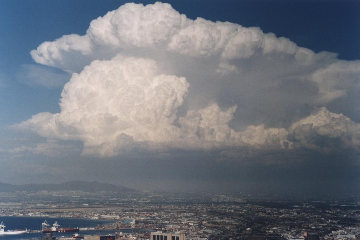
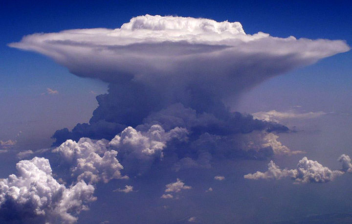
CUMULONIMBUS CLOUD: These occur at the same heights and with the same vertical growth as the cumulus clouds. These are towering thunderheads that bubble up through the troposphere. Due to the fact that they reach freezing altitudes they often become “crowned” with a giant feathering anvil top of ice crystals. They will produce heavy rain, thunder and lightning.

ANVIL TOP: The upper part of a cumulonimbus cloud that flattens and spreads out when it meets the troposphere. Usually of a fibrous or smooth appearance.

CONVECTIONAL OVERTURNING: The outer shell of a cumulus cloud is often quite stable and the pattern of it is very clear cut, because of the result of mixing cloud and unsaturated air. Toward the center of the cloud there is instability, due to mixing and increasing water content. The rate at which the mass of air in a cloud increases equals the rate of entrance through sidewalls and top, meaning the amount of air that goes in and out must be equal.

CONVECTION CURRENT: A current caused by the expansion of in this case a liquid as the temperature rises. The expanded material being less dense rises while the colder material will sink. They occur in the atmosphere above warm land masses or seas giving rise to sea and land breezes.

THUNDER: The sound of lightning, and depending on the distance or the the nature of the lightning the sound can either be a sharp loud crack, to a low long rumble. The quick increase in both temperature and and pressure from lightning creates rapid expansion of the air and this expansion creates a sonic shock wave. You can calculate the distance of lightning to you by the time between and the flash of light and the sound that follows.

LIGHTENING: A discharge of electricity in the atmosphere. In order to create lightning there must be a build up of about 300 million volts in the cloud. The earth becomes positively charged under a storm cloud and eventually a spark jumps, between the negative charge of the cloud and the positive charge of the land, in a series of jerky steps.

Wednesday, April 28, 2010

Clouds


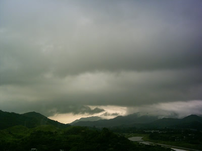
STRATUS: The base of these clouds can occur anywhere from almost ground level to about 5000 feet. They are rather dark and often have many layers with broken patches called fracto-stratus. It is quite thin and will really only produce a drizzle.


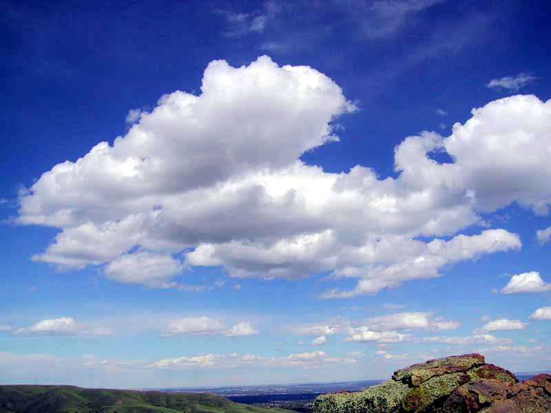
CUMULUS: These clouds often extend vertically quite high. The base can be anywhere from 1600 to 35000 feet. They are thick bubbling clouds with flat bases. Often blue sky surrounds them. They will not produce precipitation.

CUMULONIMBUS: These occur at the same heights and with the same vertical growth as the cumulus clouds. These are towering thunderheads that bubble up through the troposphere. Due to the fact that they reach freezing altitudes they often become “crowned” with a giant feathering anvil top of ice crystals. They will produce heavy rain, thunder and lightning.


NIMBO STRATUS: These type of clouds occur close to the surface of the Earth. It is often thick, enough so that ice crystals can form but it will not produce precipitation.

CIRRUS: These clouds are formed at above 20000 feet and because of the low temperatures are formed completely out of ice crystals. They are thin, feather like wisps, often streaming with the wind. They will not produce precipitation.

ALTO: These clouds range from 6500-20000 feet and are composed of water droplets. They can either be large puffs like cotton, rounded in appearance and appearing in bands like the alto-cumulus. Or they can be a thin layer of cloud, that is grayish blue as in alto stratus. They do not produce much precipitation.

Thursday, April 22, 2010

The Atmosphere

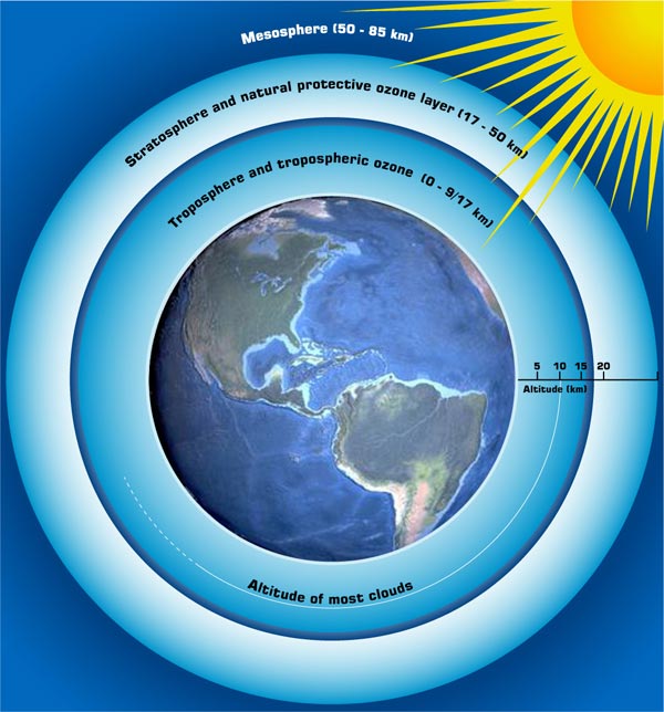
Troposphere: Contains 75% of the atmosphere's mass and 99% of the water vapour and aerosols. The average depth is about 17 km, however in tropical areas of the Earth it is around 20km, and in the poles it is closer to 7 km. Most weather conditions occur within this region of the atmosphere. The temperature drops quite drastically the higher up you go in the troposphere as well as the density and the air pressure.

Stratosphere: Right above the troposphere and extends to about 50 km. It is both drier and less dense then the troposphere. This is often where flying equipment reaches its height. There are very few to no clouds in this region due to the lack of water vapour. Due to the lack of vertical convection in this layer it means that chemicals often stay there for very long periods of time.

Ozone Layer: The ozone layer if made up of three oxygen molecules, unlike the air that we breathe in which is made up of only two. When enough of these molecules are present it causes a pale blue gas to form. It has the same chemical structure in all layers of the atmosphere however depending on its location it is either good or bad ozone. The bad ozone occurs in the troposphere. It is an air pollutant that damages humans, vegetation and other materials. In the stratosphere is the good ozone which protects the life on earth from harmful UV rays. There is much worry about the build up of bad ozone, and the deteriorating of the good ozone.